Select a link below to proceed to the login screen.

Passwords are required. For Staff only.


County of Frontenac

North Frontenac

Central Frontenac

South Frontenac

Frontenac Islands

TERMS OF USE:


Welcome to the County of Frontenacs Interactive Map Viewer Web Site. This Web Site is available to residents, guests and businesses seeking more information about the County of Frontenac. By entering the following map viewer, you are in agreement with the contents of the following disclaimer:


Disclaimer of Liability


This website is for personal and non-commercial use only.


The County of Frontenac or its employees shall not be liable for:


  • any errors, omissions, commissions or inaccuracies in the information provided in the County of Frontenacs Interactive Map Viewer, regardless of how caused;
  • any decision made or action taken or not taken by any user in reliance upon any information or data furnished hereunder; or
  • any direct, indirect, incidental, consequential, or punitive damages, or any other losses, costs or expenses of any kind which may arise, directly or indirectly from use of, or inability to use, this Web Site.

The user knowingly waives any claims for damages against any entities comprising the County of Frontenacs Interactive Map Viewer Web Site that may arise from the mapping data. All data, map images and related graphics contained on this Web Site are protected by copyright and remain the property of the County of Frontenac.


These maps are intended for general reference only and shall not be interpreted as a legal survey and shall not be used to establish legal lot sizes or dimensions. These maps should not be used for navigation.


Users may not re-sell, sublicense, or operate a service bureau using the County of Frontenac Interactive Map Viewer, or otherwise reproduce, publish or disseminate the web maps for commercial purposes, without the prior written consent of the County of Frontenac.


Includes Material © 2014 of the Queen's Printer for Ontario. All Rights Reserved.


Links to External Web Sites


Links within the County of Frontenacs Interactive Map Viewer may allow external web sites to be accessed from this Web Site. These external web site links are provided as a convenience to the end user. The County of Frontenac has not reviewed any of these external web sites and is not responsible for them or their content or any results that may be obtained from using them. The County of Frontenac does not endorse or make any representations about these external web sites, or any information or products found there. Should the end user choose to access any of the third party web sites linked to this Web Site, they do so at their own risk.


Revisions and Consents


The County of Frontenac reserves the right to revise these Terms and Conditions at any time for any reason. The County of Frontenac also reserves the right to make changes to any of the information or services contained on or offered through this Web Site at any time, without notice or obligation. By using this Interactive Map Viewer, the user acknowledges and agrees to be bound by any such revisions. Accordingly, the user agrees to visit this page periodically to review these Terms and Conditions.


I have read, understood and agree to these Terms of Use.
Enter Interactive Mapping.


Featured Applications

Frontenac Brand Amabassadors

details   | Launch Map

Launch this interactive map journal to view our Frontenac Brand Ambassadors.

County of Frontenac - Paddle Routes

details   | Launch Map

View the County of Frontenac paddle routes.

Frontenac Paramedic Services - Stations

details   | Launch Map

View the Frontenac Paramedic Services - Stations Application.

Frontenac K&P Trail - Picture Tour

details   | Launch Map

Embark on a virtual tour of the beautiful Frontenac K&P trail.

South Frontenac Cycling Routes

details   | Launch Map

View the South Frontenac Cycling Routes Application.

Frontenac K&P Trail - Elevation Profile

details   | Launch Map

View the current progress of the Frontenac K&P trail and explore the elevation profile.

Verona Community Improvement Plan

details   | Launch Map

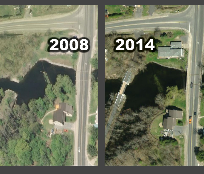
View 'Before and After' pictures of projects completed through the Verona Community Improvement Plan.

North Frontenac - Four Seasons Scenic Route

details   | Launch Map

View the North Frontenac - Four Seasons Scenic Route Application.

County of Frontenac - Imagery Swipe

details   | Launch Map

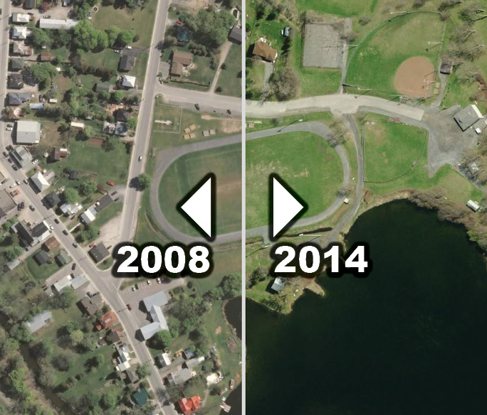
View the County of Frontenac - Imagery Swipe Application. Swipe between 2008 Imagery and 2014 Imagery.

County of Frontenac - Imagery Compare

details   | Launch Map

View the County of Frontenac - Imagery Compare Application. Compare 2008 Imagery with 2014 Imagery.

County of Frontenac - Imagery Spyglass

details   | Launch Map

View the County of Frontenac - Imagery Spyglass Application. Compare 2008 Imagery with 2014 Imagery.

County of Frontenac - Community Profiles

details   | Launch Map

View demographic and statisitical information for the County and Townships.

OFSC Interactive Trail Guide

details   | Launch Map

The Ontario Federation of Snowmobile Clubs provides this interactive trail map which outlines the trail network and conditions throughout Ontario.

Fish ON-Line

details   | Launch Map

From the Ontario Ministry of Natural Resources, this tool has robust information about the fish types in over 13,000 lakes throughout Ontario.

Hydro One - Outage Map

details   | Launch Map

Hydro One provides this online map to show outages throughout Ontario.

MTO Road Maps

details   | Launch Map

The Ontario Ministry of Transportation has several road maps available that show major roads throughout Ontario.

What is GIS?


GIS refers to a variety of computer-based systems that manage, manipulate, and analyze geographically-referenced data. Local governments have used GIS for years to manage and update property information, emergency operations, infrastructure, and environmental resources. Check out the geospatial revolution video below to better understand the power of this important technology.


Source: A public service media project from Penn State Public Broadcasting. Copyright ©2010 Penn State Public Broadcasting


Please read our Terms of Use.

TERMS OF USE:


Welcome to the County of Frontenacs Interactive Map Viewer Web Site. This Web Site is available to residents, guests and businesses seeking more information about the County of Frontenac. By entering the following map viewer, you are in agreement with the contents of the following disclaimer:


Disclaimer of Liability


This website is for personal and non-commercial use only.


The County of Frontenac or its employees shall not be liable for:


  • any errors, omissions, commissions or inaccuracies in the information provided in the County of Frontenacs Interactive Map Viewer, regardless of how caused;
  • any decision made or action taken or not taken by any user in reliance upon any information or data furnished hereunder; or
  • any direct, indirect, incidental, consequential, or punitive damages, or any other losses, costs or expenses of any kind which may arise, directly or indirectly from use of, or inability to use, this Web Site.

The user knowingly waives any claims for damages against any entities comprising the County of Frontenacs Interactive Map Viewer Web Site that may arise from the mapping data. All data, map images and related graphics contained on this Web Site are protected by copyright and remain the property of the County of Frontenac.


These maps are intended for general reference only and shall not be interpreted as a legal survey and shall not be used to establish legal lot sizes or dimensions. These maps should not be used for navigation.


Users may not re-sell, sublicense, or operate a service bureau using the County of Frontenac Interactive Map Viewer, or otherwise reproduce, publish or disseminate the web maps for commercial purposes, without the prior written consent of the County of Frontenac.


Includes Material © 2014 of the Queen's Printer for Ontario. All Rights Reserved.


Links to External Web Sites


Links within the County of Frontenacs Interactive Map Viewer may allow external web sites to be accessed from this Web Site. These external web site links are provided as a convenience to the end user. The County of Frontenac has not reviewed any of these external web sites and is not responsible for them or their content or any results that may be obtained from using them. The County of Frontenac does not endorse or make any representations about these external web sites, or any information or products found there. Should the end user choose to access any of the third party web sites linked to this Web Site, they do so at their own risk.


Revisions and Consents


The County of Frontenac reserves the right to revise these Terms and Conditions at any time for any reason. The County of Frontenac also reserves the right to make changes to any of the information or services contained on or offered through this Web Site at any time, without notice or obligation. By using this Interactive Map Viewer, the user acknowledges and agrees to be bound by any such revisions. Accordingly, the user agrees to visit this page periodically to review these Terms and Conditions.


By using this website you acknowledge and accept these terms.
© Frontenac Maps | County of Frontenac